
A great listing photograph shows a home. A well-planned aerial photograph can show why its setting matters. For a waterfront property, that may mean the relationship between the house and the shoreline. For a suburban listing, it may be the depth of the backyard, outdoor entertaining areas, or proximity to green space. For an acreage property, it may be the layout of the land and outbuildings.
That distinction makes professional real estate drone photography a useful option for agents—but not a mandatory add-on for every home. The best question is not “Can we get a drone shot?” It is “What would an aerial view help a prospective buyer understand?”
Is drone photography common in real estate in 2026?
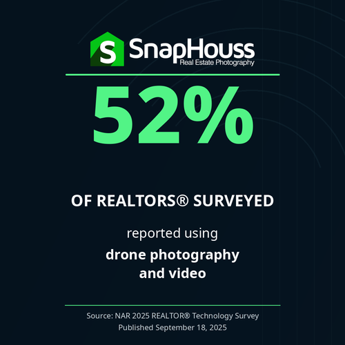
Yes, among U.S. REALTORS® it is an established marketing tool. In the National Association of REALTORS® (NAR) 2025 Technology Survey, published September 18, 2025, 52% of surveyed agents reported using drone photography and video. That figure measures adoption among surveyed NAR members; it does not show that 52% of listings include aerial media or that drone imagery increases sale prices. Source: NAR, 2025 Technology Survey.
The broader point is that aerial content is no longer limited to trophy estates. Agents can selectively include it when the location, parcel, or exterior amenities are an important part of the property's story. High-quality ground-level photographs should still anchor the listing: they show the spaces buyers will actually inhabit.
Source: National Association of REALTORS®, 2025 REALTOR® Technology Survey (Sept. 18, 2025).
Five property types where aerial photos can add meaningful context
1. Waterfront and lakefront homes
Aerial images can illustrate how a house sits relative to the water, whether there is a dock, and how the outdoor spaces connect to the shoreline. That context is difficult to convey in one front-elevation photograph. In markets ranging from Florida's Gulf Coast to Ontario's cottage regions, an overhead or angled view may explain the property's setting more clearly than a long written description.
2. Acreage, farms, and multi-building properties
Aerial photography can show the spatial relationship among the main residence, driveway, detached garage, barn, gardens, and open land. It should not be used as a substitute for a survey or to imply legal boundaries. Buyers still need authoritative documents for acreage, easements, and lot lines.
3. Homes with substantial outdoor amenities
Pools, sports courts, outdoor kitchens, large patios, and landscaped gardens sometimes make more sense when seen together. A professional photographer can pair a wide aerial establishing shot with close ground-level photographs that show materials, condition, and usable space.
4. Homes beside parks, trails, or notable surroundings
A neighborhood-scale aerial view may help explain why a particular location is appealing. The image must represent the actual setting and avoid misleading perspective. A distant landmark should not be made to appear adjacent to the property through cropping or digital manipulation.
5. Distinctive architecture or challenging lots
A hillside residence, a courtyard home, or a property with multiple rooflines may be hard to understand from the street. Aerial photography can reveal its overall form. For an ordinary small condominium, by contrast, professional interior photography and a floor plan may deserve the budget first.
What should an agent actually order?
For many suitable listings, a useful aerial package combines a small selection of still photographs and a short video sequence. Still images work well in a listing gallery and on property websites. Video can establish the property within its surroundings and then transition into the rest of a professionally produced home tour.
Ask for an aerial view that makes the property identifiable, one that communicates lot or landscape context, and—where appropriate—one that highlights a defining outdoor feature. Avoid filling a gallery with near-duplicate high-altitude images. The goal is clarity, not quantity.
Aerial media is strongest when it complements professional interiors, exteriors, a floor plan, and other relevant services. The resulting package lets buyers move from the big picture to the details without guessing how the spaces connect.
How much does real estate drone photography cost?
Pricing varies by provider, region, property size, airspace restrictions, and the number of deliverables. Rather than relying on a national “average” that may not reflect a local market, compare the specific scope: aerial stills, video, editing, travel, licensing or usage rights, and any additional approvals or rescheduling terms.
As of October 26, 2026, the SnapHouss pricing page lists an “Aerial Drone Photos (10) + Drone Video” add-on at $99.99. The published page also notes applicable taxes and a 3% online payment-processing fee. Availability, final pricing, and suitability should be confirmed for the property's service area before booking. This is a SnapHouss listed offer—not a claimed industry average.
When evaluating the investment, focus on whether the aerial footage communicates something material about the listing. A view that explains a lakefront setting may be valuable; an overhead shot of a standard interior-facing condo may add little.
U.S. and Canadian drone rules: why professional coordination matters
Drone photography is an aviation operation, not simply another camera angle. In the United States, the Federal Aviation Administration (FAA) generally regulates business drone operations under Part 107. Commercial operators need an FAA Remote Pilot Certificate, and the drone must meet applicable registration and Remote ID requirements. Flights in controlled airspace may require authorization, including through the FAA's LAANC system where available. The FAA also has specific rules for operations at night and over people. FAA commercial drone guidance; FAA LAANC guidance.
In Canada, Transport Canada uses operation categories such as basic and advanced, with requirements depending on the aircraft, airspace, proximity to people, and type of flight. Basic operations have restrictions including uncontrolled airspace and separation from bystanders; advanced operations can require additional pilot qualifications, aircraft capabilities, and air-traffic permission. Rules for microdrones differ, so a blanket claim that every Canadian drone flight requires the same certificate would be incorrect. Transport Canada: basic operations; advanced operations.
For agents, the practical takeaway is to book through a provider that can evaluate the location, use an appropriately qualified operator, and explain when a flight is not permitted or must be rescheduled. Neither a paid booking nor a seller's permission overrides airspace restrictions.
How to decide whether aerial media belongs in your listing package
Before booking, consider three questions. First, is there a meaningful exterior or location feature that buyers cannot appreciate from ground level? Second, can that feature be shown accurately and legally? Third, will the aerial images complement rather than displace essential interior and exterior photography?
If the answers are yes, aerial stills or video may strengthen the presentation. If not, allocate more of the media budget to services that better explain the property. A trustworthy media partner should help agents make that decision rather than recommend every add-on for every listing.
Frequently asked questions
Does drone photography make homes sell faster?
There is no reliable universal percentage that can be promised for every listing. Sale speed depends on price, condition, location, inventory, and many other factors. Drone imagery is best evaluated as a way to communicate property features and context—not as a guaranteed reduction in days on market.
Is drone photography only for luxury listings?
No. Waterfront homes, acreage, properties with extensive outdoor features, and distinctive lots at many price points can benefit from aerial context. Some luxury condos, conversely, may be better served by interior photography and other media.
Can a real estate agent book drone photos in both the U.S. and Canada?
Yes, where the service is offered and the flight can comply with local requirements. The applicable FAA and Transport Canada frameworks differ, and a particular address may be restricted even when nearby properties are not.
Should drone photos replace standard listing photography?
No. Aerial views explain the property and surroundings from above; professional ground-level photographs explain the rooms, finishes, condition, and living experience. The two formats serve different purposes.
Give buyers the whole picture with SnapHouss
An effective listing tells a coherent visual story: what the home looks like, how it lives, and what makes its location special. For the right property, professional aerial photography and video complete that story without replacing the essentials.
Explore SnapHouss real estate media examples, review current service bundles and aerial add-ons, and select the media that fits your next listing. Book a professional SnapHouss appointment to present the property with the right combination of photography, video, and aerial coverage, subject to local availability and flight conditions.
Editorial note: Information checked October 26, 2026. Survey findings describe respondents, not guaranteed listing outcomes. Drone regulations, local restrictions, services, and pricing may change.
