
Some property features are difficult to explain from the ground. A long driveway, a broad lawn, a wooded setting, or the relationship between a home and its outdoor spaces may not fit into a conventional exterior photograph. Real estate drone photography in Northwest Arkansas can add that missing perspective. Used thoughtfully, aerial images help buyers understand the property in context instead of asking them to assemble the full picture from separate ground level views and a written description.
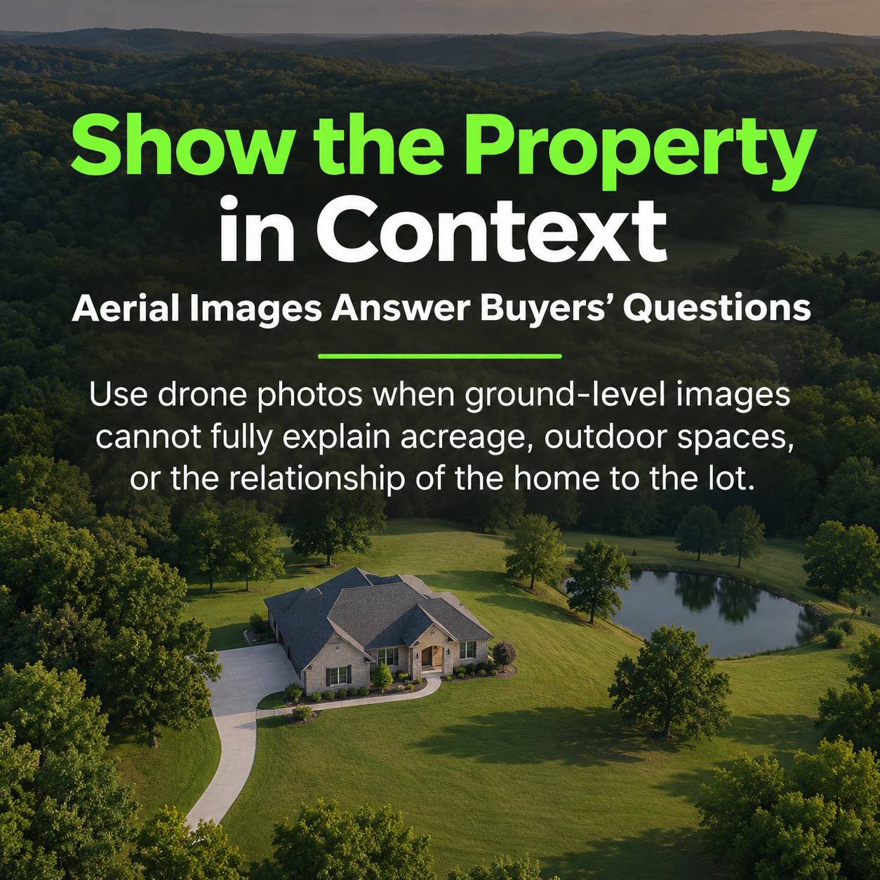
The strongest drone images answer a question. Where does the home sit on the lot? How does the backyard connect to the house? What surrounds the property? What does the approach look like? These are useful questions for Realtors marketing homes, acreage, and land throughout Benton and Washington counties. At SnapHouss, we approach aerial imagery as part of the property story. The goal is to show relevant information clearly and give prospective buyers another reason to explore the listing.
Begin with the information buyers need
Before requesting aerial photographs, identify what a higher viewpoint will explain. A home on a compact lot may benefit from a modest elevated angle that reveals its roofline and backyard. An acreage listing may need a wider view to show open space and the arrangement of improvements. A property with a winding approach may benefit from a photograph that connects the entrance to the home. The appropriate image depends on the listing rather than a standard altitude or dramatic effect.
Share those priorities before the shoot. Your photographer may see opportunities that differ from the views you initially imagined, and site conditions can influence the available angles. A useful briefing describes the feature and why it matters: the workshop behind the home, the patio beside the pool, or the clearing within a wooded parcel. This is more helpful than simply asking for more drone photos. It gives the team a clear purpose while leaving room for professional judgment.
Show acreage as a connected property
Acreage can be difficult to communicate through close exterior photos alone. A buyer may see a beautiful house without understanding the open ground, trees, outbuildings, or access surrounding it. Aerial photography can connect those elements within one frame. It can also show differences between areas of the property, such as an open lawn near the house and a wooded area farther away. Those relationships can help prospective buyers decide what they want to investigate during an in person visit.
Choose images that make the subject recognizable. An extremely wide photograph may show impressive countryside while leaving viewers uncertain about the actual listing. Pair a broader context image with a closer view where the home or parcel is easy to identify. For land marketing, provide the photographer with accurate reference information before discussing any overlays. Aerial photographs illustrate what is visible; they should not imply verified acreage, access rights, buildability, or other details that have not been established through appropriate property information.
Explain outdoor living spaces
Decks, patios, pools, gardens, and detached structures can be important parts of a property’s appeal. From ground level, these elements may look disconnected or be partly hidden behind the house. A carefully chosen aerial angle can show how they work together. Buyers can see whether a patio sits beside the kitchen, how a pool relates to the backyard, or where an additional building stands in relation to the main residence and its driveway.
Preparation still matters. Put away pool accessories, organize outdoor furniture, move visible trash cans, and clear temporary items from areas that will appear in aerial views. A drone can reveal spaces that are less noticeable from the front door, including side yards and storage areas. Walk the exterior with that broader perspective in mind. When the property is ready, the photographer can focus on a clear composition rather than trying to avoid distracting objects from every possible angle.
Use location pins and labels with a purpose
Location pins and labels can help explain an aerial photograph when the viewer needs orientation. A label might identify the listed property, an adjoining road, or a visible landmark relevant to the marketing story. For example, a wide photograph may show a recognizable destination in the distance, but the relationship may not be obvious without a restrained label. The label should make the photograph easier to understand while preserving enough unobstructed imagery to show the setting.
Keep labels consistent, readable, and accurate. Use the same pin style and text treatment across related images. Avoid placing large graphics over the property itself or crowding the frame with every nearby destination. Check names and placement before publishing. A photo showing a landmark does not establish a particular driving time, walking route, access entitlement, or ownership connection. If a caption makes any of those claims, the Realtor should confirm them separately instead of relying on what the image appears to suggest.
Treat lot outlines as explanatory graphics
Lot outlines can make a land or acreage image easier to follow, especially when trees, fields, and neighboring properties blend together. Their usefulness depends on the quality of the reference supplied and the clarity of the final graphic. Ask the client or Realtor for the relevant boundary reference before editing begins. Make sure the correct parcel is being discussed and that the selected camera angle can support an understandable illustration without hiding key parts of the property.
An illustrated outline should be described as approximate and should not be presented as a survey. The article or caption should direct buyers to confirm boundaries through appropriate property documents and professional advice when needed. From a visual standpoint, a restrained line generally leaves more of the landscape visible than a heavy graphic. Review the image at phone size before approving it. Buyers should be able to identify the property without mistaking a decorative overlay for precise technical documentation.
Connect aerial images with ground level photography
Aerial images provide context, while ground level photographs help buyers understand the home and its usable spaces. A good listing gallery uses both when appropriate. Begin with a strong introduction to the property, then use an aerial view to explain its setting. Follow with exterior and interior images that develop the story. The exact sequence depends on the home, but each image should add information rather than repeat an almost identical view from a slightly different position.
For a property with a distinctive backyard, consider a sequence that moves from the living area to the patio and then to an aerial view of the outdoor layout. For acreage, introduce the residence before showing the wider land context and any additional structures. This progression lets viewers connect the spaces they might use with the surrounding property. Aerial photography becomes more valuable when it helps a buyer interpret the rest of the listing instead of functioning as an unrelated spectacle.
Decide when still photos or video fit the story
Still aerial photographs let viewers pause and inspect details. They can be especially useful when comparing the placement of buildings, looking at outdoor features, or understanding a labeled context view. Drone video adds movement and can reveal a property gradually, such as approaching a home or widening the view to show its setting. Neither format automatically replaces the other. Choose based on the information you need to communicate and the channels where the media will be used.
A short social video might use a small number of purposeful aerial shots, while a listing gallery may need several carefully differentiated still images. Discuss intended formats before the appointment so the team understands whether the priority is a property website, listing photographs, or social content. Vertical and horizontal presentations can emphasize different parts of a scene. Planning ahead helps preserve the property and any important labels within the frame instead of forcing an awkward crop after the footage is captured.
Plan for the conditions at the property
Drone work depends on weather, airspace restrictions, and site conditions. An aerial view that looks straightforward on a map may not be practical at the appointment. Trees, overhead obstacles, surrounding activity, and the available operating area can affect what is possible. Discuss the request before the shoot, particularly when the property has unusual access or surroundings. Let the photography team assess the situation rather than treating a specific flight or angle as guaranteed.
Season and light also change the appearance of a property. Leafy trees may emphasize a wooded setting while hiding portions of the ground. Different lighting conditions can make outdoor spaces easier or harder to read. Your photographer can help determine which available views communicate the listing clearly. Accurate presentation remains the priority. Aerial media should help viewers understand the property as it is being marketed, with any illustrative graphics or separate conceptual imagery clearly distinguished from photographs of existing conditions.
Choose clarity when selecting the final images
Before publishing, review aerial photos on a phone as well as a larger screen. Check whether the property is easy to locate, labels remain readable, and the composition supports the article or listing description. Remove redundant images. A small selection with clear differences often tells a more coherent story than a long series of nearly identical views. For an educational post about drone photography, choose examples that demonstrate a specific benefit readers can recognize immediately.
SnapHouss serves Realtors throughout Northwest Arkansas with photography and other booked property media services. If your listing in Bentonville, Rogers, Fayetteville, Bella Vista, or the surrounding communities has features that deserve a broader perspective, tell us what buyers need to understand. We can discuss how aerial imagery may fit the shoot, subject to the conditions at the property. Book your next shoot at https://snaphouss.com/ and let’s create a clear visual story that connects the home, the land, and the setting.
